DNA
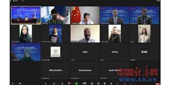
BEIJING, Aug. 15: The Advanced Seminar on Geomatics Technology for Pakistan sponsored by the Ministry of Commerce of China is ongoing online to help improve Pakistani scientists and officers’ expertise in geomatics, China Economic Net (CEN) reported on Monday.
It’s learned that a total of 19 Pakistani experts and officers from the Society of Engineering, National Institute of Computer Sciences, University of AJ & K Muzaffarabad, etc. attended this seminar.
According to the seminar’s organizer Hunan International Business Vocational College, the seminar is specifically designed to meet the actual needs of Pakistani geo-technical experts based on a series of investigation and research on the development of surveying and mapping technology in Pakistan.
During the 20-day seminar, Chinese experts have been sharing the latest geomatics technology of data analysis, processing and application, and the successful experience and practice in the surveying and mapping industry in China with the Pakistani participants.
The seminar is composed of classroom teaching, discussion on specific topics and visits to renowned Chinese enterprises, etc. Notably, cutting-edge equipment including VR drones has also been used for practice.
“Through this seminar, Pakistani experts can learn about the updated development of geomatics technology in China, and the Sino-Pak cooperation potential in the field of surveying and geographic informatics has been fully discussed,” Zhong Huiqun from Hunan International Business Vocational College told CEN.
It’s learned that in recent years seminars on various subjects including automotive industry, engineering and business management have been organized by Hunan International Business Vocational College under the sponsorship of the Ministry of Commerce of China to help drive Pakistan’s industrial upgrading and enhance technical exchange between the two countries.


